
BergeSeen Trail Stage 20
From Grünau in Almtal to Lake Laudach
From the tourism office in Grünau (at the town hall), the trail leads out of the valley along the main street, then heads left along the Flößerweg path and across the Grünaubach bridge. The route continues for 300 metres along the river und crossing over to other bank via a bridge.
The route continues down a long and scenic hiking trail alongside the rushing Alm River in the direction of the village of Scharnstein. After 4.7 kilometres (1 ¼ hours of trail time), the path arrives at a train crossing and the Kothmühle stop.
Immediately after the train crossing, the trail turns left into a small road which leads to the community of Matzing. The route continues to the north until arriving at the access road leading from the Segelflugplatz to Hochbuchegg (path no. 413 to Lake Laudach). The trail continues left along the road for 300 metres and then turns right into another small road. The route ascends along the road whose curves are shortened via cut-through paths to the splendid Hochbuchegg farmstead (742 metres).
The trail now begins the six-kilometre journey to Lake Laudach. The route first follows a forest road for approximately 300 meters, then goes left on a foot path along a mountain ridge and continues uphill to arrive at a forest road. Following this road, the trail soon reaches the hunting lodge Jagdhaus Schrattenau (981 m).
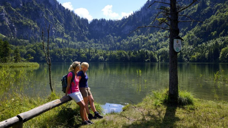
From the hunting lodge, the trail heads west along a path which serves to shorten the curves of the forest road. It then continues along the road to a junction. The route turns left continuing along level terrain and then descending to the gorgeous surroundings of Lake Laudach (894 m). A rest stop at the Rausaualm tavern is recommended.
From Lake Laudach to Gmunden
The last section of the Salzkammergut Trail leads from Lake Laudach along a forest nature trail towards Gmunden (path no. 410).
The route continues to lightly ascend and descend along a broad hiking trail passing carved wooden figures along the way to a junction. To the left, the path leads down to the eastern shore of Lake Traun. However our route continues straight ahead and ascends to the summit of the Grünberg Mountain (1004 m). On Saturdays and Sundays, hikers can make a rest stop at the nearby Grünbergalm.
From the Grünberg, hikers can use the cable car to reach the valley below. The cable car is open until 5 pm (6 pm during the main summer season).
The final descent of this long-distance trail follows path no. 410 to the junction with the Mitterweg path. Here the route heads downhill to the left to the community of Weyer.
Bearing right, the trail goes along the shore of Lake Traun on a beautiful path to the city centre of Gmunden. Upon reaching Gmunden, the large circular route of the long-distance trail is finally complete.
Many prominent figures have explored this region: nobles like Archduke Johann and Empress Elisabeth, scientists such as Friedrich Simony, poets and authors like Nikolaus Lenau, painters like Ferdinand Georg Waldmüller, musicians and composers such as Johannes Brahms. Did they ever think that hiking in the Salzkammergut might have no end? That they could tramp from one lake to the next and then onward to yet another? Day by day along the shores of crystal-clear waters? Week-long excursions through quiet valley forests, over sunny alpine meadows and up mountains fuelled by the anticipation of the next destination? Further information…
Safety Tips for Hikers
Admittedly, the landscape of the UNESCO World Heritage region of Hallstatt Dachstein Salzkammergut is the absolute pinnacle for hiking fans, mountain enthusiasts and nature lovers—unforgettable tours to incredibly beautiful mountain lodges and meadows, panorama views as far as the eye can see and cherished moments that will last a lifetime! However, you should remember that while hiking you might find yourself in high-alpine terrain. We’ve put together some resources to assist you: how to best prepare for your tour, recommended items for your backpack and steps to take in an emergency situation. Remember to always play it safe and enjoy your hiking adventure in the Salzkammergut!
Warning: Closed trails
Better to know before you go
Hiking trails in the Salzkammergut can be closed for various reasons. To help you prepare for your hike, we have set up a page with current road closures in the region. This will help you get to your destination without any detours or stress. Click here to visit the page...